ZIP Code vs ZCTA: Why a ZIP Is Not a Boundary
A ZIP Code is a set of mail delivery routes. A ZCTA is an area the Census Bureau draws to approximate it. Here is why the two disagree, and what that means for any ZIP lookup, including ours.
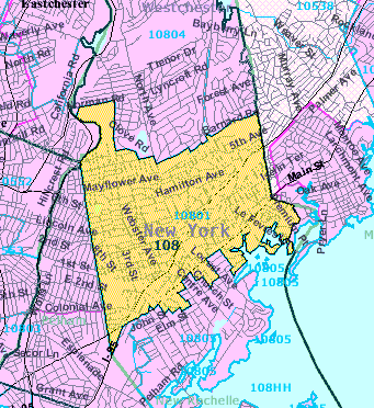
If a map says your house is in one ZIP Code and your mail says another, neither is necessarily broken. They are describing two different things. A ZIP Code belongs to the Postal Service and describes how mail is delivered. The shaded ZIP areas you see on maps and in data files are usually something else: ZIP Code Tabulation Areas, or ZCTAs (pronounced "zik-tahs"), which the Census Bureau describes as a geographic product of its own.
The short answer
So, are ZIP Codes boundaries? No. The Census Bureau's definition, as quoted by the Princeton University Library, is that USPS ZIP Codes are not areal features but a collection of mail delivery routes.
The USPS adds that ZIP Codes do not necessarily adhere to city or municipal boundaries.
A ZCTA is the Census Bureau's attempt to turn those routes into a shape that can be drawn on a map and used to count people. It is a reasonable approximation for statistics and a poor way to settle which ZIP a particular address uses for mail. The ZIP shown by this site's tools is a ZCTA guess, so confirm a mailing ZIP with the USPS (see below).
What a ZIP Code actually is
Think of a ZIP Code as a delivery grouping. The USPS says ZIP Codes must be designed to reflect the actual Post Offices, delivery units, and carrier routes
. A carrier route is a list of stops, and a list of stops has no outline.
Because the routes belong to the Postal Service, the USPS can change them. Its own FAQ says it will occasionally add a new ZIP Code or change ZIP Code boundaries.
What a ZCTA is and how the Census Bureau draws one
Statisticians want to publish numbers by ZIP Code, and numbers need areas. The Census Bureau's solution is the ZCTA. According to its ZCTA page, ZCTAs are generalized areal representations of the geographic extent and distribution of the point-based ZIP Codes
, built using 2020 Census tabulation blocks. Census blocks are the small building-block areas the Census Bureau uses to tabulate its counts.
The key rule is that each block belongs to exactly one ZCTA. For a block that has housing, the Census Bureau gives it the ZIP Code carried by most of its addresses. The ZCTA is then the set of blocks that were given the same ZIP Code. The page also says ZCTA coverage includes zero-population blocks enclosed within a ZCTA, which is why a ZCTA can cover land with no mail. The result is a clean shape with an edge, even though the ZIP it approximates has none.
Notice what that rule throws away. If most of a block's addresses are in one ZIP and a few are in another, the few are counted under the majority ZIP. The map is right about the block as a whole and wrong about those few doors.
Where a ZIP and its ZCTA part ways
Three differences cause most of the confusion.
- Some ZIPs have no ZCTA. The Census page says it directly:
Not all valid ZIP Codes are represented by a 2020 ZCTA.
A ZIP you know from your mail may be missing from ZCTA data. - Timing. The current ZCTAs are built from 2020 Census blocks, while the USPS can change ZIP Codes at any time. A ZIP created or changed since then will not be reflected in them.
- Majority rule. As above, a block takes the most common ZIP among its addresses. Individual addresses can disagree with the ZCTA around them.
So a ZCTA is for tabulating statistics, and the Postal Service is the authority on mail.
A worked example
Imagine a census block with ten addresses along one street. Seven of them have mail addressed to ZIP A and three to ZIP B, because the carrier for B reaches them from the next street over. The Census Bureau assigns the whole block to the ZCTA for A. On a ZCTA map, all ten addresses sit inside area A.
Now take one of the three B addresses. A lookup that assigns each address to the ZCTA containing it says A, since that is the area its block belongs to. The USPS says B, since that is the route that delivers to it. Only the USPS answer tells you what to write on an envelope.
How this site uses ZCTAs
Everything on mylocationis.com that shows a ZIP is based on ZCTAs, not USPS data.
- The What Is My ZIP Code? tool returns the ZCTA with the nearest centre point, not the one whose outline contains you. Near an edge or in a large rural ZIP it can name a neighbour, even where the block-based answer would be correct. Use it as a starting point.
- The ZIP to county lookup reads the Census ZCTA-to-county file and lists every county a ZCTA touches. A ZIP with no ZCTA returns no match.
- The city lookup uses Census place boundaries, so it can differ from the city on your mail.
Treat the USPS as the final word on the mailing ZIP.
How to confirm a mailing ZIP with the USPS
Use the USPS's own Look Up a ZIP Code tool. You enter an address, which is the right input, because the route depends on the address and not on a pin on a map. Enter the full address as it appears on mail, including any unit number. The USPS says ZIP changes will be reflected in the lookup within 30 to 60 days
, so for a brand-new address, ask your local post office.
If you are joining data by ZIP
Data users hit the same wall in a different form. Datasets keyed by USPS ZIP (customer lists, health records, sales) will not all match a ZCTA-keyed Census table. The Census Bureau's relationship files describe how Census geographies relate to each other; they are not a lookup from USPS ZIPs. The usual first step is to match your ZIP to the ZCTA code, because the Census page says all 2020 ZCTA codes are current valid USPS ZIP Codes. Then list the ZIPs that do not match and handle them on purpose: look them up in a third-party crosswalk whose vintage and method you have checked, or exclude them and report that you did. State which ZCTA vintage you used. Remember too that a ZCTA is a statistical area, so a ZIP-level statistic describes the blocks inside the area, which can differ from the people on the mail routes.
Sources
- U.S. Census Bureau: ZIP Code Tabulation Areas (ZCTAs)
- Missouri Census Data Center: ZIP code resources
- USPS: ZIP Code, the basics
- Princeton University Library FAQ quoting the Census Bureau definition
- USPS: Look Up a ZIP Code
- U.S. Census Bureau: relationship files
About this page
Maintained by the mylocationis.com editors. Last reviewed . Spotted a mistake? Use Contact and say which page.